Saturday, September 30, 2006
Friday, September 29, 2006
Sumac & Graffiti

Bushes and weeds have grown up all around this concrete barricade at the end of the street. The bright red sumac bush compliments the blue graffiti.
.Here is a Google Maps satellite image of where this photo was taken or you can copy and paste the following coordinates into Google Earth:
43 53' 17.12"N, 78 51' 20.55"W
Thursday, September 28, 2006
Wednesday, September 27, 2006
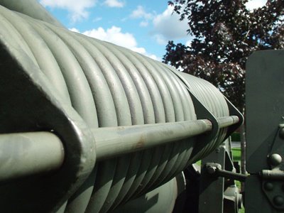
WWII M1 125mm Howitzer Gears
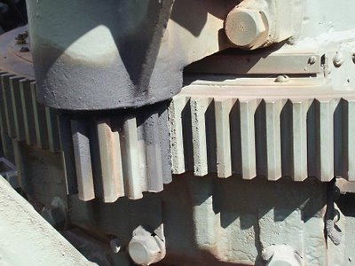
Sometimes the individual parts are more interesting than the whole. These aiming gears are on a WWII M1 125mm Howiter on display in front of the Oshawa branch of the Royal Canadian Legion.
Here is a Google Maps satellite image of where this photo was taken or you can copy and paste the following coordinates into Google Earth:
43 53' 05.96"N, 78 51' 28.00"W
Saturday, September 23, 2006
1960 Fleetside
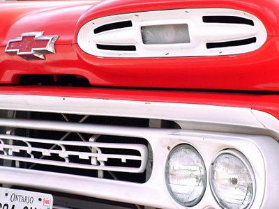
1960 Chevy Fleetside Pickup Truck
While walking downtown along some of the residential streets just off the main drag I came upon this beautifully restored pickup. The stone chips are evidence that it is not just a pretty show car, but driven regularly. Sitting in the cargo box, wrapped in clear plastic was a newly rebuilt big blog engine. If it is destined to be installed in this truck, it's going to be one mean machine.
Here is a Google Maps satellite image of where this photo was taken or you can copy and paste the following coordinates into Google Earth:
43 53' 01.81"N, 78 51' 18.09"W
Friday, September 22, 2006
Abandoned But Not Forgotten

This old RR crew shack is on a CPR spur line running through Oshawa serving industries in the region. Only a few trains move along this line each day, but they do so at a very high rate of speed. I think this graffiti artist has livened up this old building a bit. It is most likely slated for demolition in the near future as CPR abandons secondary lines because most freight is now moved by road.
Here is a Google Maps satellite image of where this photo was taken or you can copy and paste the following coordinates into Google Earth:
43 53' 16.22"N, 78 51' 20.43"W
Thursday, September 21, 2006
Red Flannels
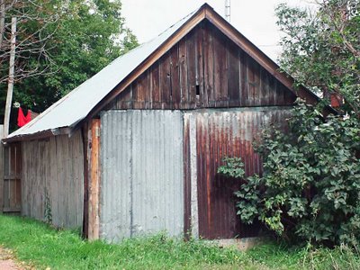
Second Avenue, Oshawa
A sure sign that winter is approaching is the appearance of red flannel long underwear. Stanfields are a Canadian institution in winter underwear. The company located in Truro Nova Scotia, is owned by the family of former Nova Scotia Premier, Robert Stanfield. He was also the former leader of the Canadian Progressive Conservative Party and candidate for Canadian Prime Minister in 1968 & 1974, going down to defeat against the Liberals led by Pierre Elliot Trudeau.
Here is a Google Maps satellite image of where this photo was taken or you can copy and paste the following coordinates into Google Earth:
43 53' 02.87"N, 78 51' 17.39"W
Wednesday, September 20, 2006
Birdhouse

Southmead Park, Oshawa
I walk past this spot a couple of times a week and have never noticed this birdhouse before. The other day, when I was in hiding, hoping to photographing some deer that come to feed on fallen apples in a corner of Southmead Park I heard some birds squacking. When I looked up I saw the birdhouse attached to the the tree in the garden of a house that backs on the park. The park sits above the woods and marsh at the mouth of Oshawa Creek. I stepped back to photograph the birdhouse and noticed the roof of the old, weather beaten shed. I like how the new birdhouse contrasts with the old garden shed.
Here is a Google Maps satellite image of where this photo was taken or you can copy and paste the following coordinates into Google Earth:
43 52' 02.28"N, 78 49' 59.65"W
Tuesday, September 19, 2006
Shack
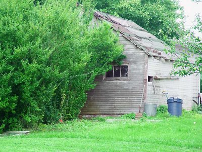
I was walking Dog through a park in my neighbourhood when I spotted this weather worn shed. I like old out buildings like this. They show that things have a tendency to revert back to nature quickly. It was really hazy and the image was very washed out, so I did the best I could in Photoshop, but you can only do so much. If it isn’t there, it isn’t there.
Here is a Google Maps satellite image of where this photo was taken or you can copy and paste the following coordinates into Google Earth:
43 52' 02.81"N, 78 50' 01.71"W
Sunday, September 17, 2006
Stairway to Heaven
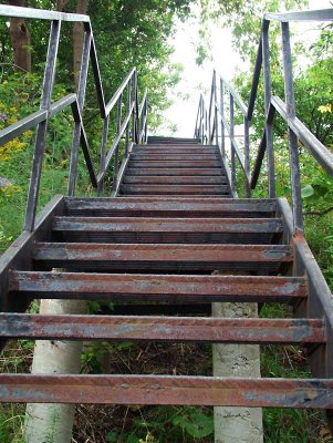
Depends on whether you are going up or down. These iron stairs lead up from the valley that Oshawa Creek runs thought. They are at the rear of the former Conant Public School at the end of my street. The school has now closed and classes have moved to a newer, larger facility at the oposite end of the street and has been renamed Bobby Orr Public school, after the Boston Bruins hockey star. More on that anomoly in a future post.
Here is a Google Maps satellite image of where this photo was taken or you can copy and paste the following coordinates into Google Earth:
43 52' 09.91"N, 78 50' 44.85"W
Saturday, September 16, 2006
Friday, September 15, 2006
Seat of Government
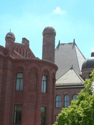
Queen's Park, Toronto
Queen's Park is where the Ontario Government meets when in session. It is situated on Queen's Park Circle, in the heart of Toronto. Queen's Park is an island of land, an oasis of green, created where University Avenue spits and encircles the Ontario Legislature buildings.
Here is a Google Maps satellite image of where this photo was taken or you can copy and paste the following coordinates into Google Earth:
43 39' 45.48"N, 79 23' 31.47"W
Thursday, September 14, 2006
Aspiring to Higher Education
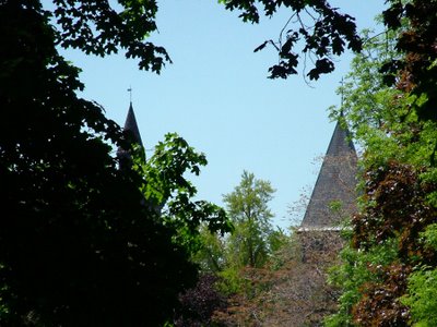
University of Toronto
This shot was taken from Queen's Park, Ontario's parlaiment, across Queen's Park Circle. The spires are on buildings in the University of Toronto.
Here is a Google Maps satellite image of where this photo was taken or you can copy and paste the following coordinates into Google Earth:
43 39' 42.68"N, 79 23' 35.75"W
Wednesday, September 13, 2006
Saturday, September 09, 2006
Thursday, September 07, 2006
Renovation
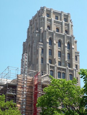
Queen's Park Circle, Toronto
I don't know what building this is, but the statues on the facade indicate that is had something to do with labour. The building in the foreground, clad in scaffolding, appears to be the entrance to the edifice.
If you have Google Earth, you can copy and paste the following coordinates to see a satellite image of where this photo was taken:
43 39' 45.02"N, 79 23' 23.29"W
Wednesday, September 06, 2006
Tuesday, September 05, 2006
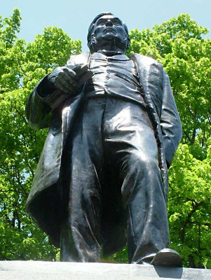
Battle of Batoche
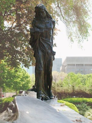
Queen's Park, Toronto
Queen's Park is the seat of government for the Province of Ontario. This statue is hidden behind some bushes ouside the western rotunda of the provincial parlaiment buildings. It commemorates the Battle of Batoche where the Metis were defeated in May of 1885, and the Metis rebel, Louis Riel surrendered. He was later hanged for treason.
If you have Google Earth, you can copy and paste the following coordinates to see a satelite image of this building:
43 39' 45.13"N, 79 23' 33.60"W
Monday, September 04, 2006
Last Chance Texaco
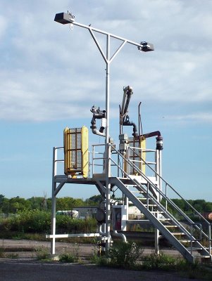
Fuel Fill-Up Station, Port Oshawa
This tanker truck fill-up station is in an abandoned tank farm in the Oshawa port lands. There are a number of faded names on the tanks attributing previous ownership of the facility. The first owner appears to be Texaco.
If you have Google Earth, you can copy and paste the following coordinates to see a satellite image of where this photo was taken:
43 51' 58.78"N, 78 49' 43.36"W
Sunday, September 03, 2006
Space to Let
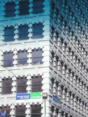
Adelaide & Yonge Streets, Toronto - August 2006
Although this picture does not this building justice, I think it is one of the more beautiful offices towers in Toronto. Unfortunately the owners have blemished the facade with the ugly rental sign. The blue gradient is from the tinted windscreen of my car.
Saturday, September 02, 2006
Big Silver Bird
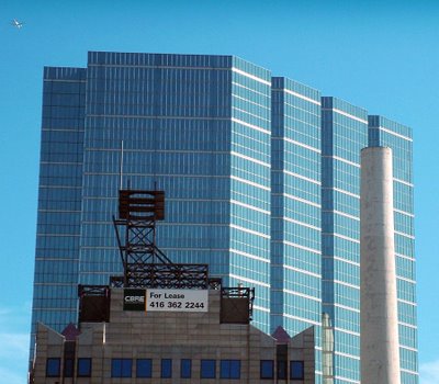
University Avenue & King Street West, Toronto - August 2006
I took this shot through the car windscreen from the intersection of University Avenue & Adelaide Street West, hence the gradient. I hadn't noticed the jet plane until I download my images to the computer.
If you have Google Earth, you can copy and paste the following coordinates to see a satelite image of this building:
43 38' 51.65"N, 79 23' 07.94"W
Friday, September 01, 2006
Wires
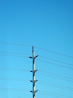
I was sitting in my car waiting for my companion when I snapped this throwaway picture. I had no expectations and was going to delete it after I had downloaded the camera to the computer. I had a quick look at it and liked what I saw.
If you have Google Earth, you can copy and paste the following coordinates to see a satelite image of this photo:
43 50' 35.20"N, 79 01' 19.24"W
Reflection
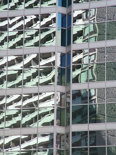
Corner, Gerrard & Bay Streets, Toronto.
I was waiting for the traffic light to change at Gerrard and Bay Streets, one of the busiest intersections in Toronto, when this reflection caught my attention out of the corner of my eye. I only had a few seconds to take this shot as the light was about to change and you never want to keep impatient Toronto drivers waiting, lest you receive the universal sign of displeasure along with a good dose of horn.
If you have Google Earth, you can copy and paste the following coordinates to see a satellite image of this photo:
43 39' 27.43"N, 79 23' 02.06"W
